

Switserland – Homann Heirs, 1751
€375
SWITZERLAND IN THE MID-18TH CENTURY
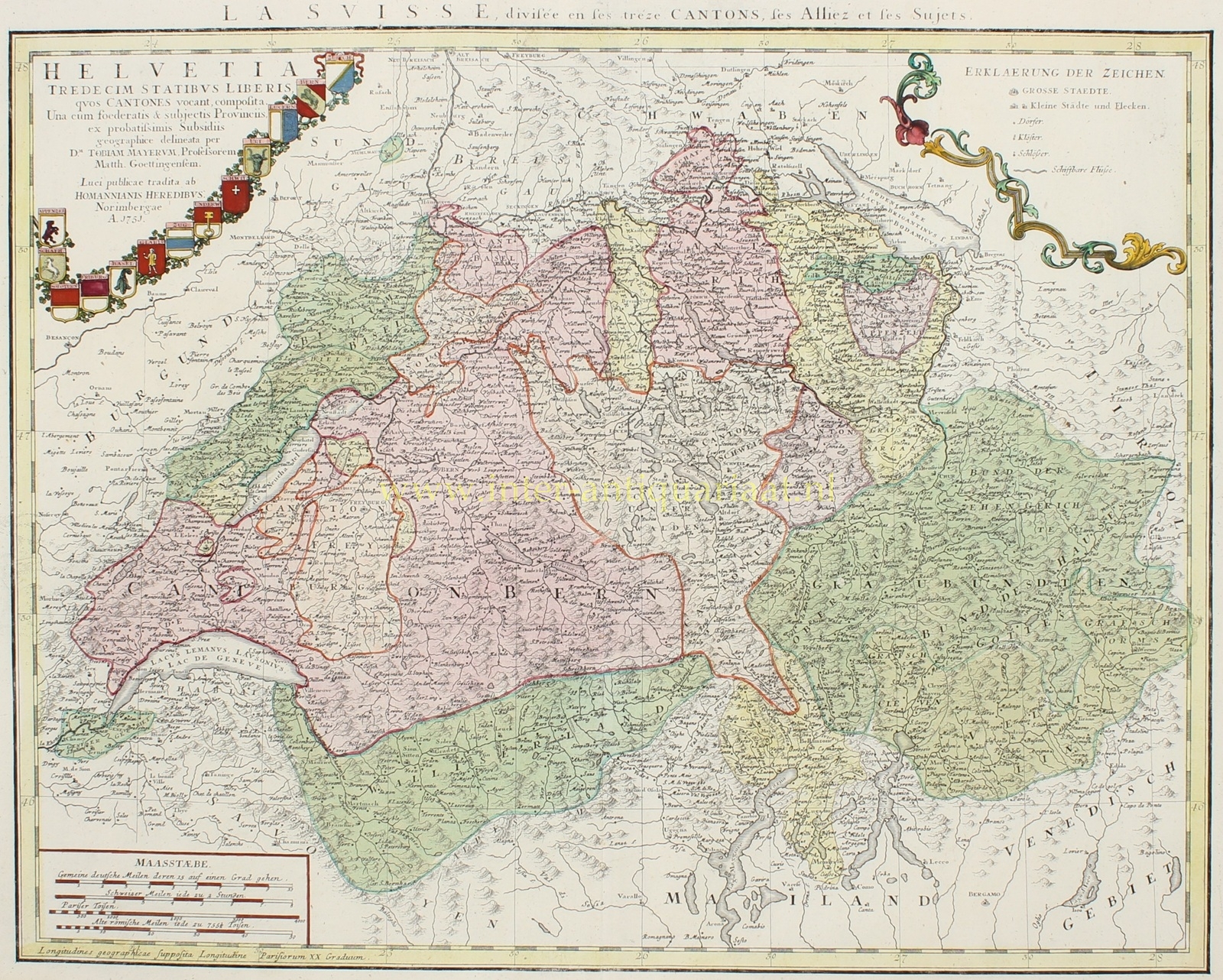
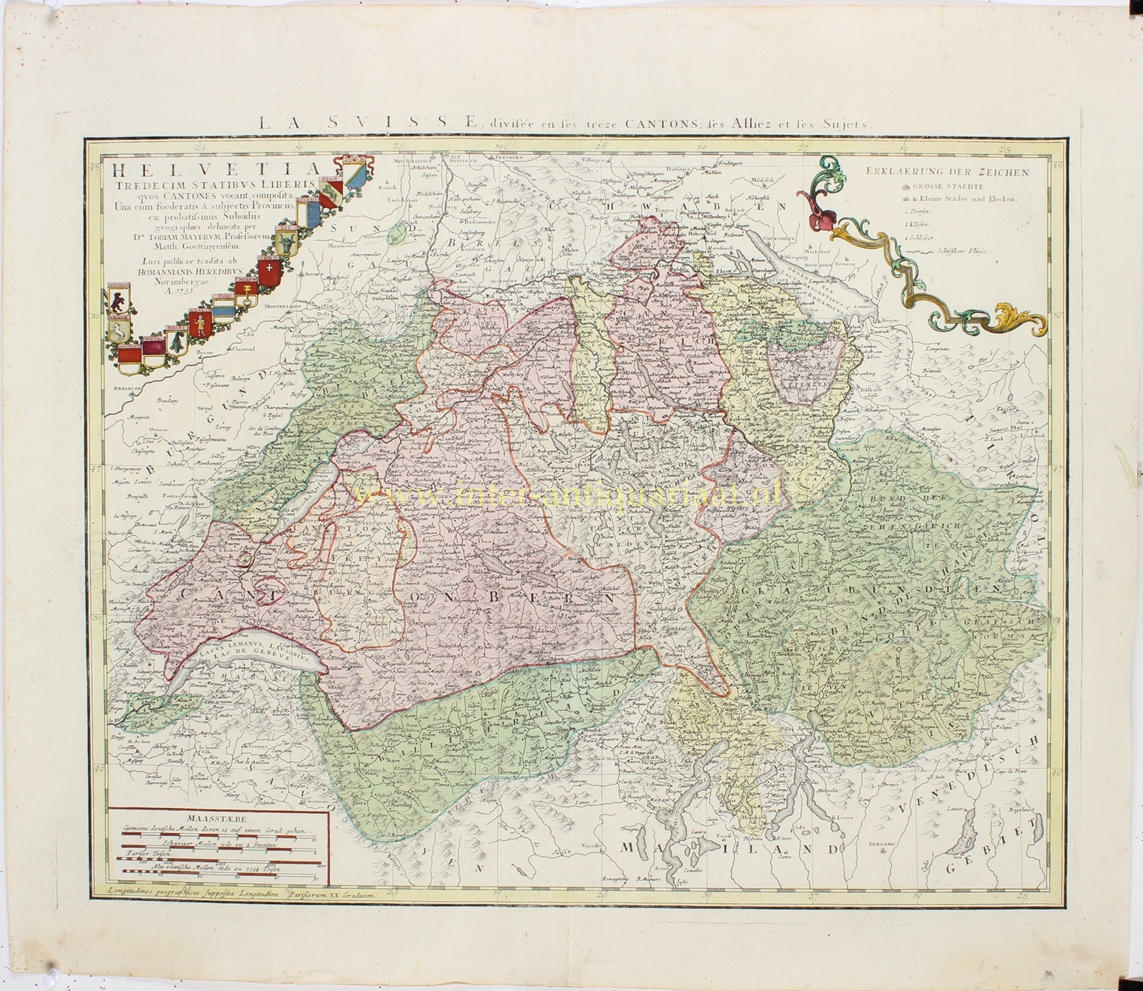
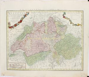
“La Suisse, divisée en ses treze Cantons, ses Alliez et ses Sujets” / “Helvetia Tredecim Statibus Liberis quos Cantones vocant, composita. Una cum foederatis & subjectis Provinciis” [Switzerland, consisting of thirteen free states, known as cantons, together with the allied and subject territories]. Copper engraving after a map by Tobias Mayer, published by Homann Heirs in Nuremberg in 1751. Original hand colouring. Size (map image): 40 × 52 cm.
This detailed map depicts Switzerland in the mid-eighteenth century, when the country was not yet a unified state but consisted of a complex arrangement of independent cantons, allied territories and subject lands. The map provides a fascinating picture of the political and geographical structure of the Old Swiss Confederacy, as it existed before the far-reaching changes of the late eighteenth century.
Since 1513, the Swiss Confederacy had consisted of thirteen cantons, including Zurich, Bern, Lucerne, Uri, Schwyz, Basel and Schaffhausen. In addition, several territories were linked to the Confederacy by treaties, including Geneva, Neuchâtel, Valais and the Three Leagues in Graubünden (Grisons). Other territories were governed directly or jointly by one or more cantons. These complex territorial relationships are clearly distinguished on the map by coloured boundaries and areas. The extensive territory of Bern, which at the time also included most of what is now the canton of Vaud, is particularly prominent.
The map is exceptionally rich in topographical detail. Hundreds of towns, villages, hamlets, monasteries and castles are carefully marked, together with rivers, lakes, roads and mountain ranges. The map extends from Lake Geneva in the southwest to Lake Constance in the northeast, and from the Jura Mountains in the northwest to the Italian lakes and Alpine regions in the south. The mountainous landscapes of Graubünden, Valais and the Bernese Oberland are represented through an intricate network of mountain ranges and valleys.
The title cartouche in the upper left corner is surrounded by an elegant arrangement of the coats of arms of the thirteen cantons. A second cartouche in the upper right corner contains a legend explaining the map symbols. Several scale bars are provided in the lower left corner.
The map was produced by the German mathematician, astronomer and cartographer Tobias Mayer (1723–1762), who worked for the renowned Nuremberg map-publishing firm established by Johann Baptist Homann between 1746 and 1751. Mayer was known for his pursuit of greater geographical accuracy and his application of mathematical and astronomical methods to cartography. In the same year that this map was published, he was appointed professor of mathematics at the University of Göttingen. He later achieved international recognition for his research into the motion of the Moon.
Price: Euro 375,-