

North Sea – Richard Seale, c. 1744
€250
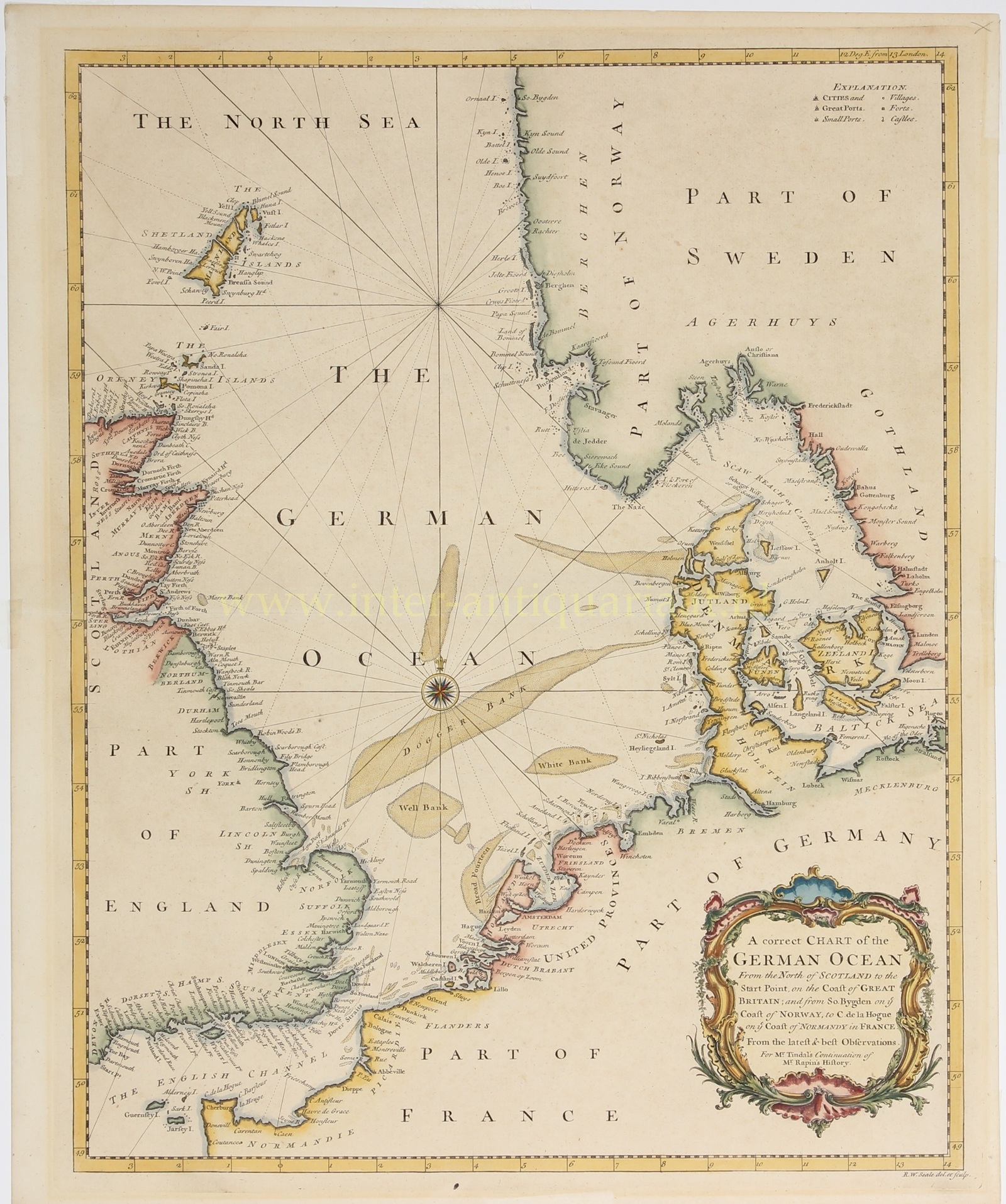
“A Correct Chart of the German Ocean. From the North of Scotland to the Start Point, on the Coast of Great Britain; and from So. Bygden on the Coast of Norway, to C[ap] de la Hogue on the Coast of Normandy in France.” Copper engraving made around 1744 by Richard William Seale.” Coloured by a later hand. Size: 47 × 37.4 cm.
This sea chart of the North Sea (then in English also known as the “German Ocean”, from the Latin “Oceanus Germanicus“) depicts the principal maritime thoroughfare of north-western Europe: the waters between England and the trading cities of the Low Countries, Bremen and Hamburg, the Danish straits, and the approaches to the Baltic Sea.
Seale carefully delineated coastlines, islands, river mouths, harbours, and capes and headlands of importance to navigation. A key at upper right distinguishes towns and villages, major and minor ports, forts, and castles. Shoals and sandbanks are also prominently marked, including the Dogger Bank, Well Bank, and White Bank. For vessels at sea, such banks were dangerous obstacles but also important points of orientation.
The map is not, however, a hydrographic chart in the modern sense. It lacks soundings, detailed coastal profiles, and local sailing directions. Rather, it served as a general chart of the extensive sea space between England and continental Europe: accurate enough to establish the position of ports, coasts, and hazardous banks, but not intended as an independent instrument for piloting a vessel along a difficult coastline.
The map appeared in Nicolas Tindal’s (1687–1774) Continuation of Mr. Rapin’s History of England, which presented English history not merely as a succession of royal reigns, but also as the development of Protestant liberty, parliamentary government, and British maritime power. In his original Histoire d’Angleterre, Paul de Rapin (1661–1725) had treated English history up to the Glorious Revolution of 1688; Tindal continued the narrative to the accession of George II in 1727. Its numerous maps, prints, portraits, and genealogical tables made the publication a visually rich and politically charged work of reference for eighteenth-century readers. Within this context, the North Sea was not a neutral expanse of water, but the maritime arena in which England, the Dutch Republic, France, Scandinavia, and the states of the German coast met economically, diplomatically, and militarily.
Price: Euro 250,-
