

Scandinavia – Justus Danckerts, c. 1687
€650


SCANDINAVIA DURING THE SWEDISH GREAT POWER ERA
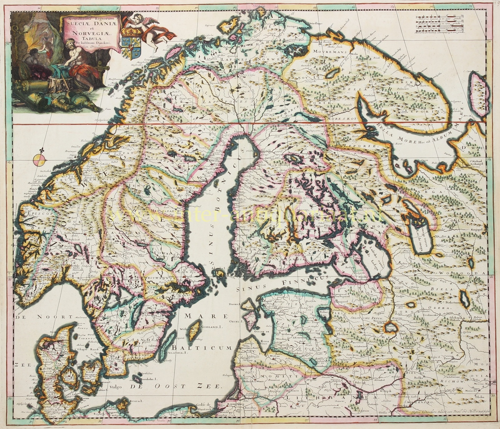
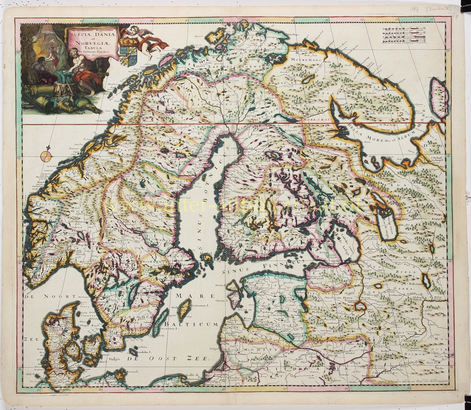
“Accuratissima regnorum Sueciae, Daniae et Norvegiae tabula.” [A most accurate map of the kingdoms of Sweden, Denmark and Norway.] Copper engraving published in Amsterdam by Justus Danckerts, c. 1687. With attractive original hand colouring. Size: 49.5 × 57.5 cm.
This general map of Scandinavia and the Baltic region shows Denmark, Norway, Sweden and Finland, together with the coasts of northern Germany, Poland, Estonia, Livonia and north-western Russia. Cities, rivers, lakes, mountain ranges and landscapes are densely recorded; subtle colour accents distinguish the numerous provinces and administrative territories. Four separate scale bars give Swedish, Danish, Norwegian and German miles respectively, an appropriate solution for a map bringing together different realms and local systems of measurement.
The map was produced at a time when Sweden had attained the height of its political and territorial influence in northern Europe. Finland then formed an integral part of the Kingdom of Sweden. The former Danish provinces of Scania, Halland, Blekinge and Bohuslän are likewise naturally shown as part of Sweden: they had been ceded to Sweden in 1658, following the Treaty of Roskilde. The map was moreover published shortly after the Scanian War of 1675–1679, during which Denmark–Norway had unsuccessfully attempted to recover these territories.
Norway is named as a separate kingdom, but at the time formed part of the Danish–Norwegian monarchy. Denmark and Norway remained united under one crown until 1814. The map therefore does not depict three equal independent states, but a northern Europe in which expansionist Sweden faced the composite realm of Denmark–Norway.
The decorative title cartouche in the upper left reinforces this political dimension. Alongside the Swedish royal arms, the imagery refers to Sweden’s mineral wealth and iron production, as well as to the military strength on which Swedish great-power status largely rested.
The vast Baltic Sea and Gulf of Bothnia form the geographical centre of the map: not as a peripheral part of Europe, but as a connected sphere of trade and power linking Scandinavia, Germany, Poland and Russia.
Price: Euro 650,-
