

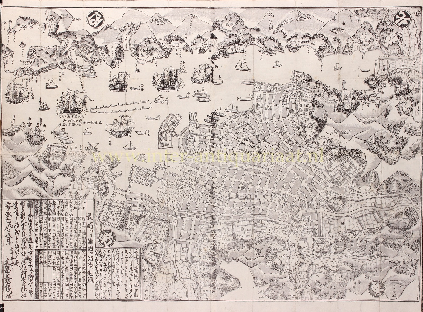
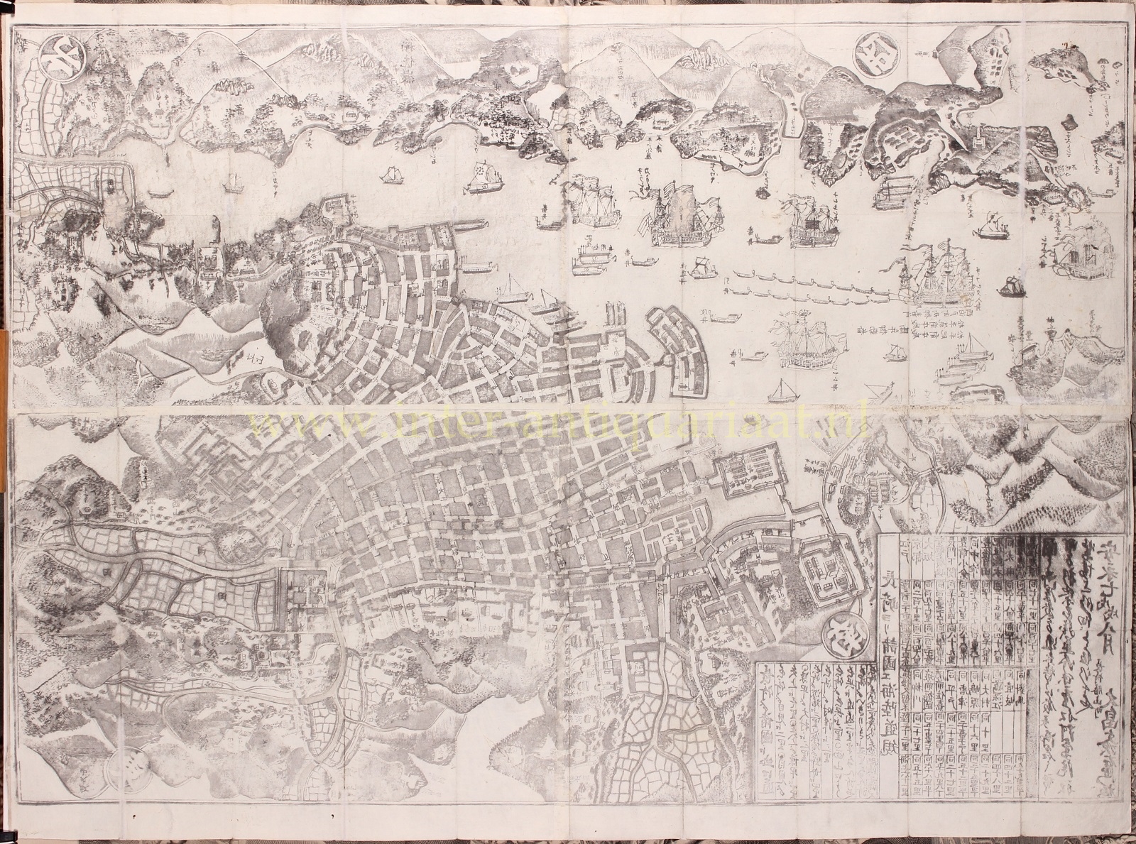

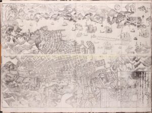
NAGASAKI HARBOUR WITH THE DUTCH FACTORY OF DEJIMA
“Hishū Nagasaki no zu” (illustration of the prosperous Nagasaki), woodcut published in 1778 (An’ei 7) by Ohata Bunjiemon. Size: 61,3 x 86,7 cm.
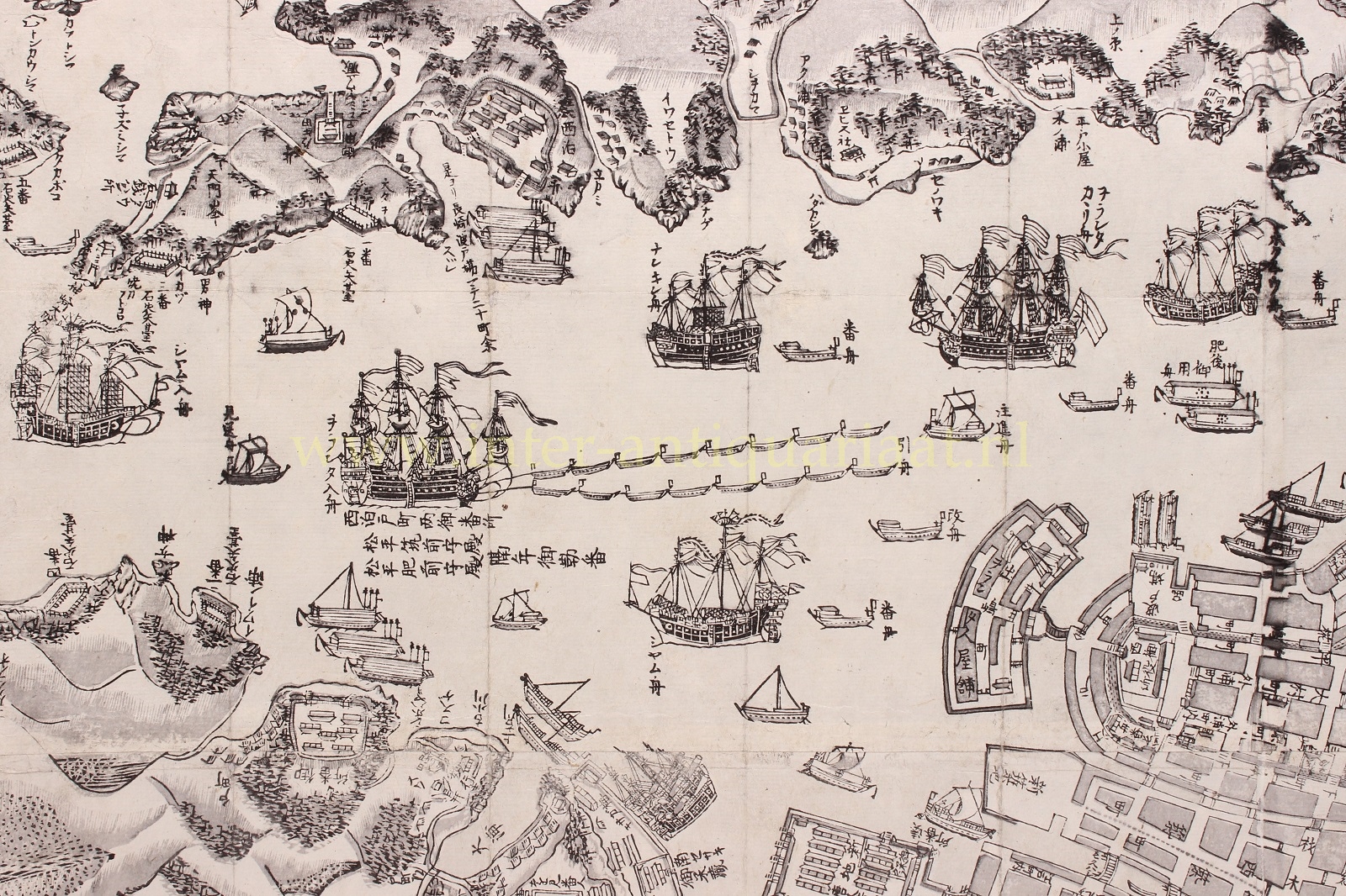
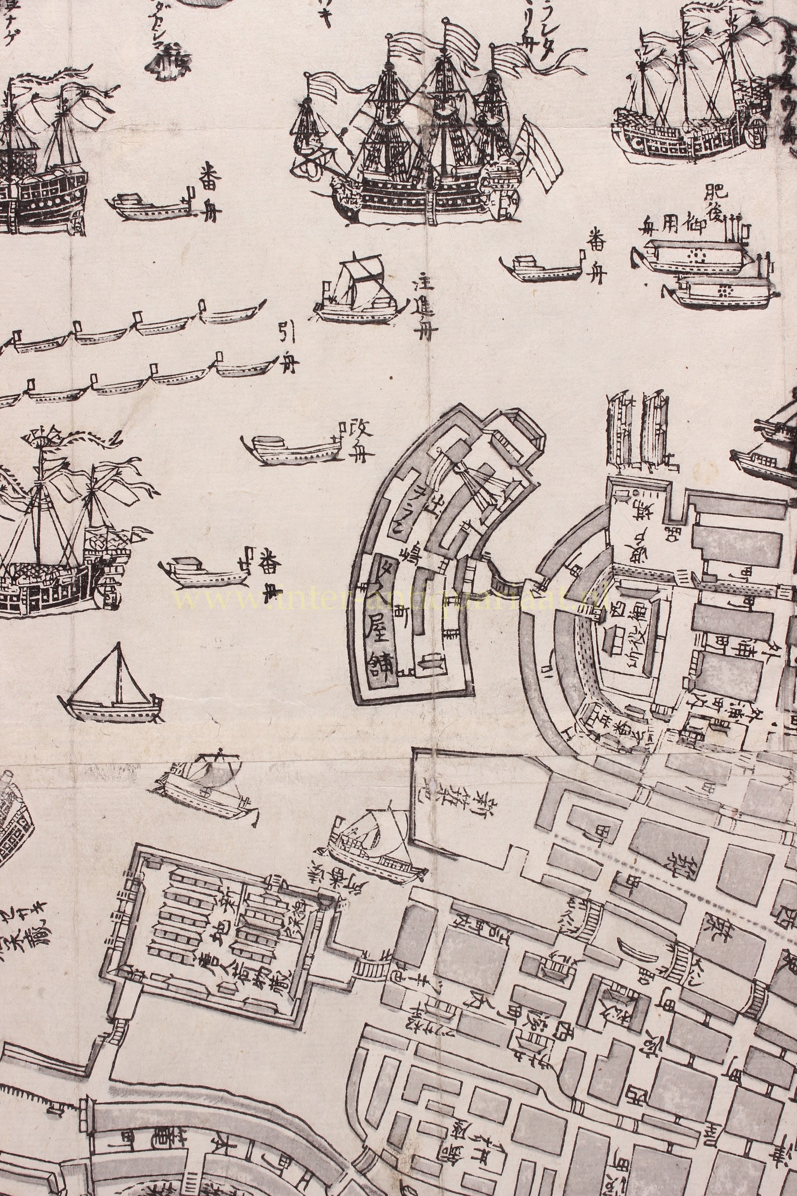
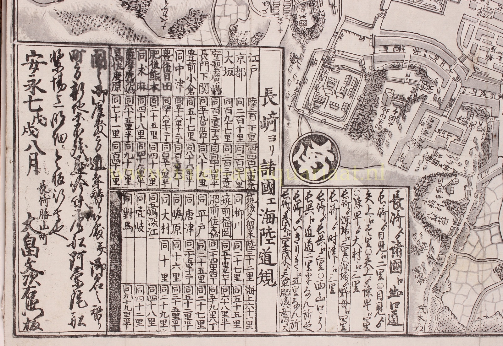
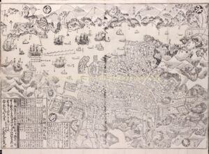
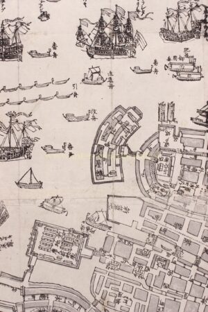
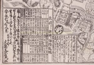
The map is oriented diagonally, with straight North pointing to the upper right corner of the map. This allows an aesthetically pleasing depiction of the ships horizontally entering and exiting the port. The orientation places the Dutch factory Dejima (築島), a fan-shaped island, in the centre of the map as its subject. Next to the Dutch factory, the map shows also the Chinese factory. At the bottom left there is a chart describing the distances from Nagasaki to various city centres. These calculations include the distances travelled by land and by sea. It states for instance, that the distance from Nagasaki to Osaka is 197 ri (Japanese miles) by land, and 235 ri by sea. Furthermore, the map provides a reasonably detailed image of the city with streets, temples, shrines, waterways, a significant number of ships and boats, gardens, and fortifications. Many of these are captioned on the map.
After the expulsion of the Portuguese from Japan, only Chinese and Dutch ships were allowed to come to Japan, and Nagasaki was the only harbour they were allowed to enter. Dejima became the factory ground for the Dutch East India Company (VOC) in 1641. Dejima was Japan’s sole contact with Europe until the late 1850s.
On the map, we see the Dutch island with a flag, a few houses, a docking area for ships, and the bridge that connected the trading post to the mainland. At the time the map was made, the artificial island consisted of warehouses and a few residences, indicated as gray blocks and houses with roofs. Life on Dejima was monotonous. The Dutch residence had to abide by strict rules, and special permission was required to leave the island.
This is one of the earliest Japanese maps of Nagasaki, with more to follow – each edition slightly altered and improved – in 1821 and a slightly smaller version of this map again 40 years later, at the end of the 1860s, when more foreign traders had settled in Nagasaki.
This is so-called Nagasaki-e print, a type of print that is depicting particular characteristics of Nagasaki, is a woodblock print that became popular in the Edo period. They often depict foreigners or foreign objects, such as ships. These prints answered the curiosity the Japanese held towards foreigners on their land, and were often bought by Japanese travellers during their stay in Nagasaki.
Due to the vulnerability of the thin paper on which they were printed, they have become rare nowadays.
Price: Euro 2.450,-