

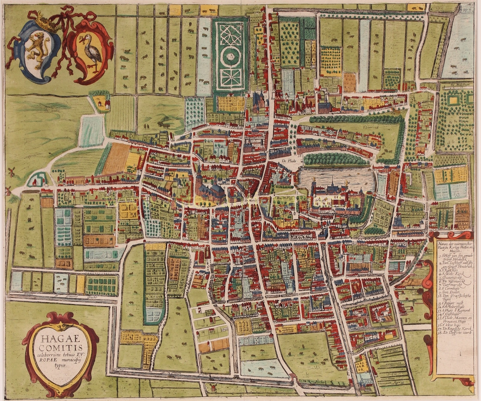
THE HAGUE AT THE BEGINNING OF THE 17TH CENTURY
“HAGAE COMITIS celeberrimi totius EUROPAE municipij typus”, copper enrgaving from the “Theatrum urbium Celebriorum totius Belgii sive Germaniae Inferioris,” part II, published in Amsterdam by Jan Jansson (Johannes Janssonius) in 1657/58. Coloured by a later hand. Size (print): 38.4 x 46.1 cm.
There was a lot of construction in the first half of the 17th century because The Hague’s population underwent expansive growth. In 1585, there were an estimated 7 to 8,000 inhabitants, barely more than in 1500. By 1600, that number had risen to 12,000, and by 1625, to 18,000. This was partly due to immigrants from the Southern Netherlands or rural people seeking a new life in the city.
This map, for which the copperplate was made in 1616, is an accurate depiction of the city at the beginning of the 17th century. Government officials were found in the generously proportioned houses on Kneuterdijk, Voorhout, or Vijverberg, and also along main streets like Noordeinde. Independent tradespeople and merchants preferred to establish themselves along thoroughfares where they were clearly visible or along new harbours and canals. There, they could benefit from transportation facilities or passing traffic. Servants, soldiers, and night watchmen often lived in the rear, in alleys and gates behind the houses of the more affluent or in narrow side streets.
The copper plate for this engraving was made for the townbook by Georg Braun and Franz Hogenberg. Forty years later, Jan Jansson used the same, by then outdated plate for his own townbook. By that time, the Singel canal had already been completed. An updated improved map had been brought to the market by Joan Blaeu in 1649.
Price: Euro 1.250,-