

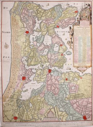

ONE OF THE MOST IMPORTANT CARTOGRAPHIC REGISTRATIONS OF NORTH HOLLAND
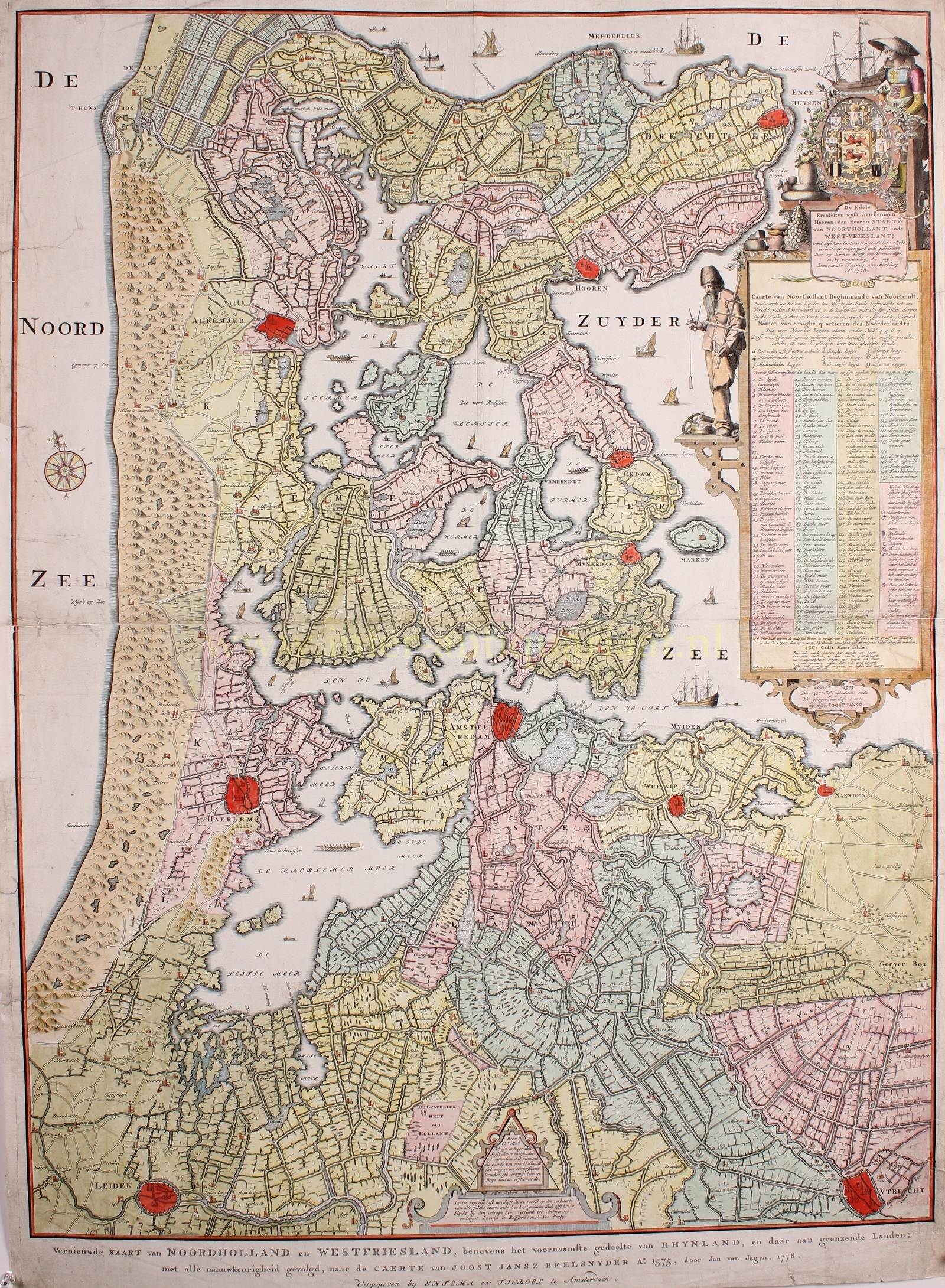
“Vernieuwde Kaart van Noordholland en Westfriesland, benevens het voornaamste gedeelte van Rhynland, en daar aan grenzende Landen.” [Renewed map of North Holland and West Friesland, in addition to the largest part of Rijnland, and adjacent territories.] Copper engraving after a design by Joost Jansz. Beeldsnijder, reissued in Amsterdam by Yntema and Tieboel in 1778. Coloured by a later hand. Size: 92 x 68 cm.
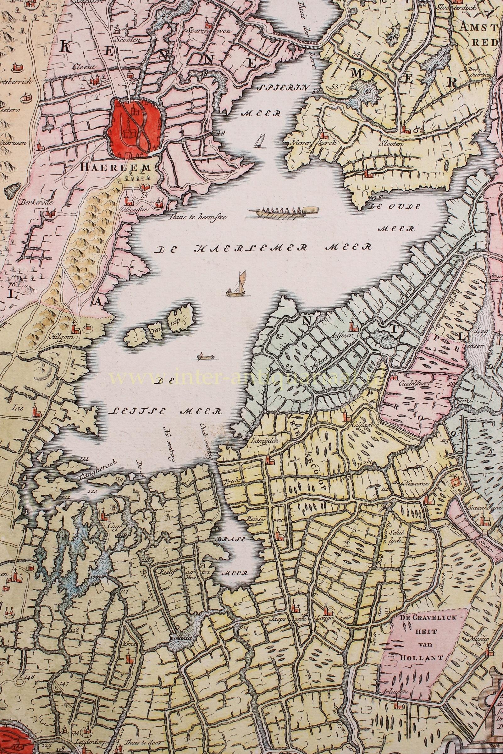
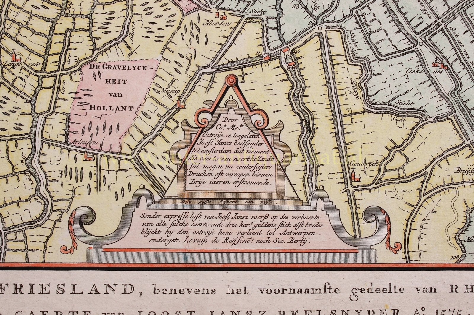
The map by Joost Jansz. Beeldsnijder was originally issued as a woodcut in 1575, of which unfortunately no copies have survived. It was commissioned by the Grand Duke of Alba and was to serve for the campaigns of the conquest of northern Holland during the Eighty Years’ War. The maze of lakes, dikes, rivers and inaccessible places in this difficult area therefore required a good overview map. Beeldsnijder had already gained a lot of knowledge of the area from his practice as a land surveyor at the Hof van Holland and was well able to map the entire area within a relatively short time.
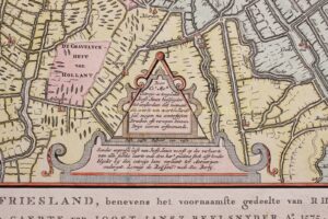
The map shows the situation in northern Holland at the time that the permit for the reclamation of the Beemster lake had already been granted by the States General of the Republic (May 1607) (the map indiates that the De Beemster lake is currently getting dikes). The first major reclamation of land, of lake Zijpe (1597), is also depicted, but otherwise Holland is still dangerously rich in water.
Capturing of this moment in time is important as soon after, numerous changes would transform the region. Inland water was a major concern, often greater than the sea. How did one get rid of it and how did one prevent further erosion of the vulnerable, peat-rich banks of the lakes? Various inventions, such as better mills and phased drainage, but also the presence of a rich merchant city with wealthy investors, set in motion a process whereby all the large and many smaller lakes were drained within less than half a century. The entire water management situation was radically changed by the reclaimed land. A system of barge canals was also built in a short period time. Beeldsnijder’s map gives such a clear picture of this area before those changes, that various historical reconstruction maps have chosen it as a starting point.
Beeldsnijder’s map was reissued with minor changes in 1608 and (this copy) re-engraved by Jan van Jagen and published in 1778.
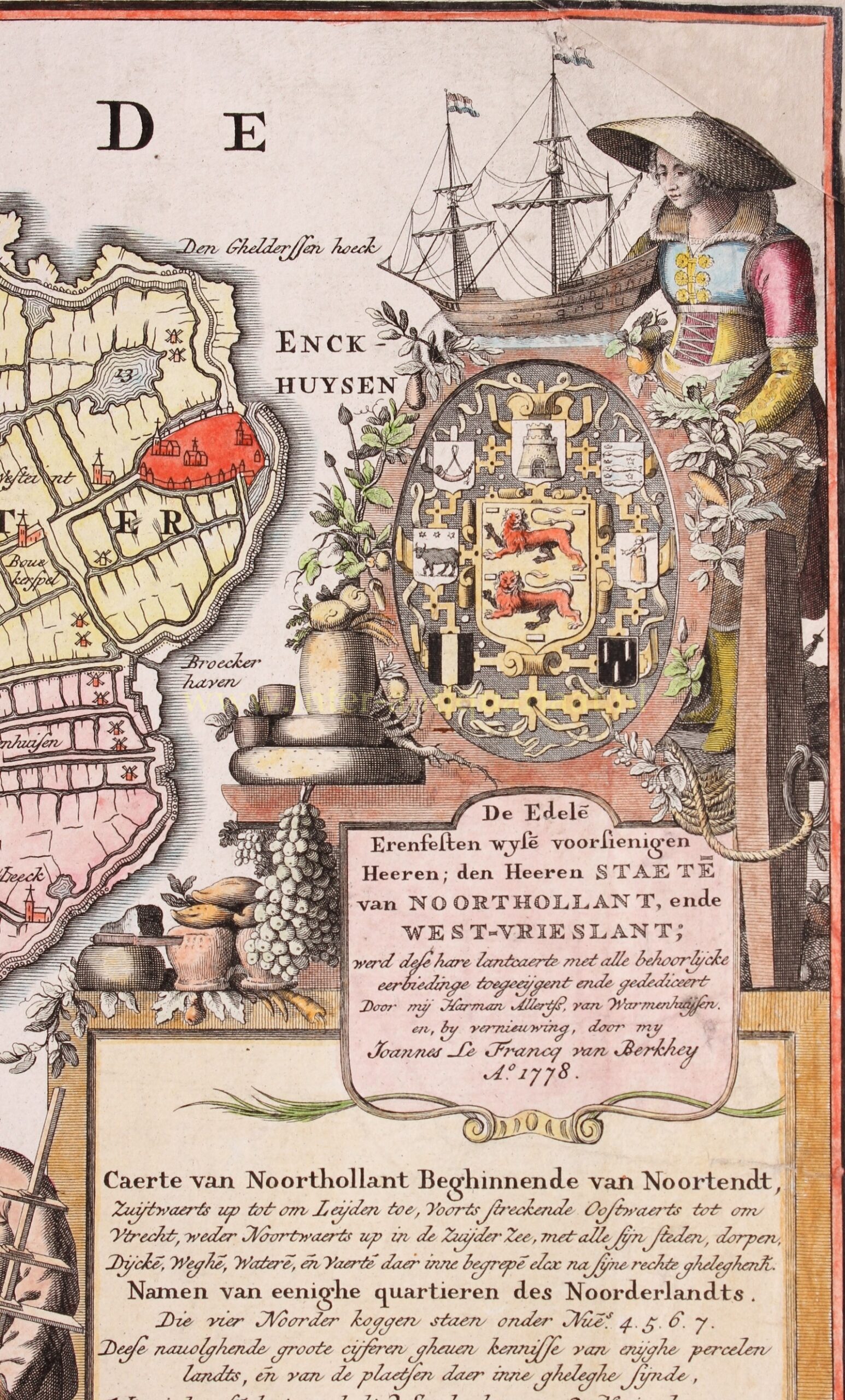
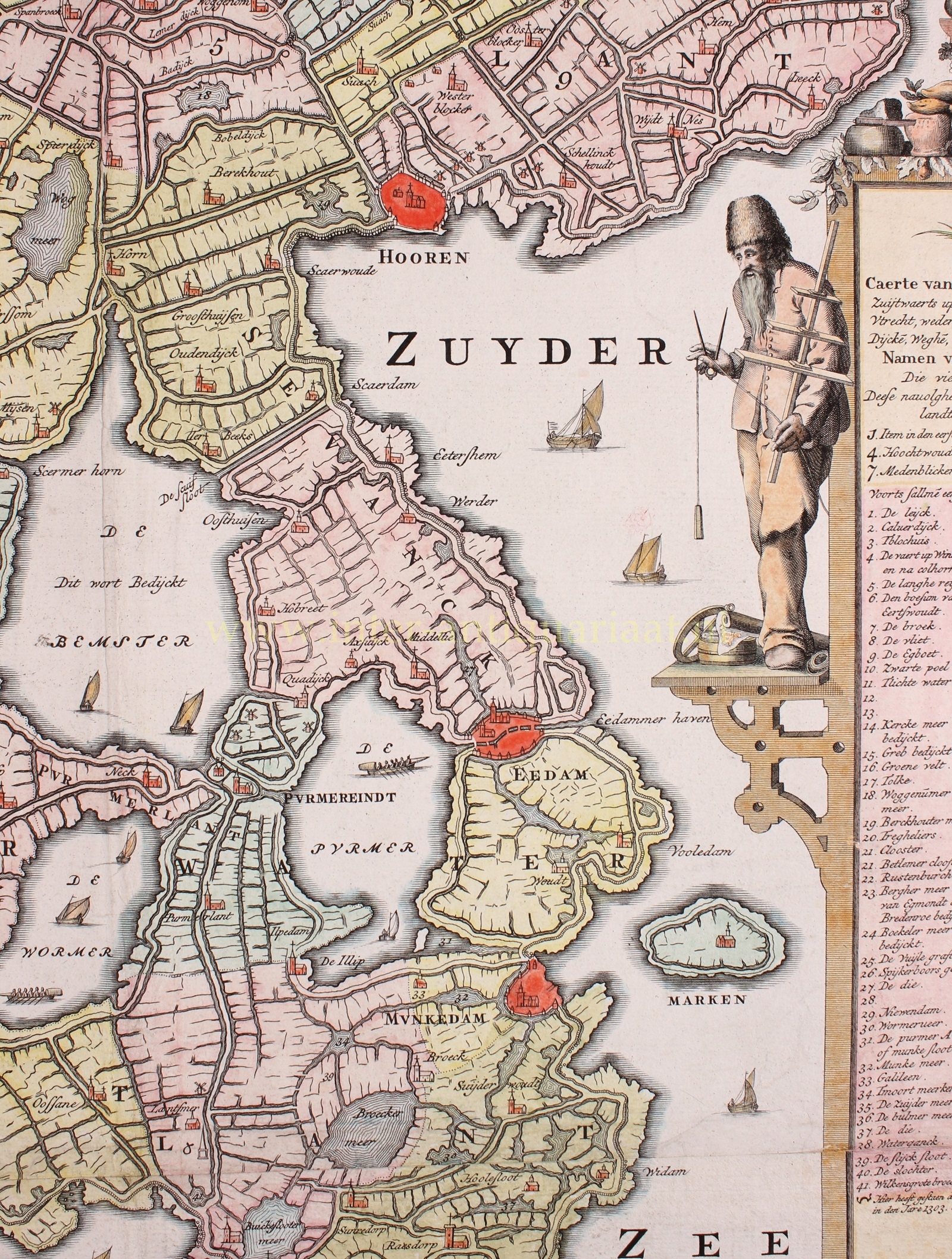
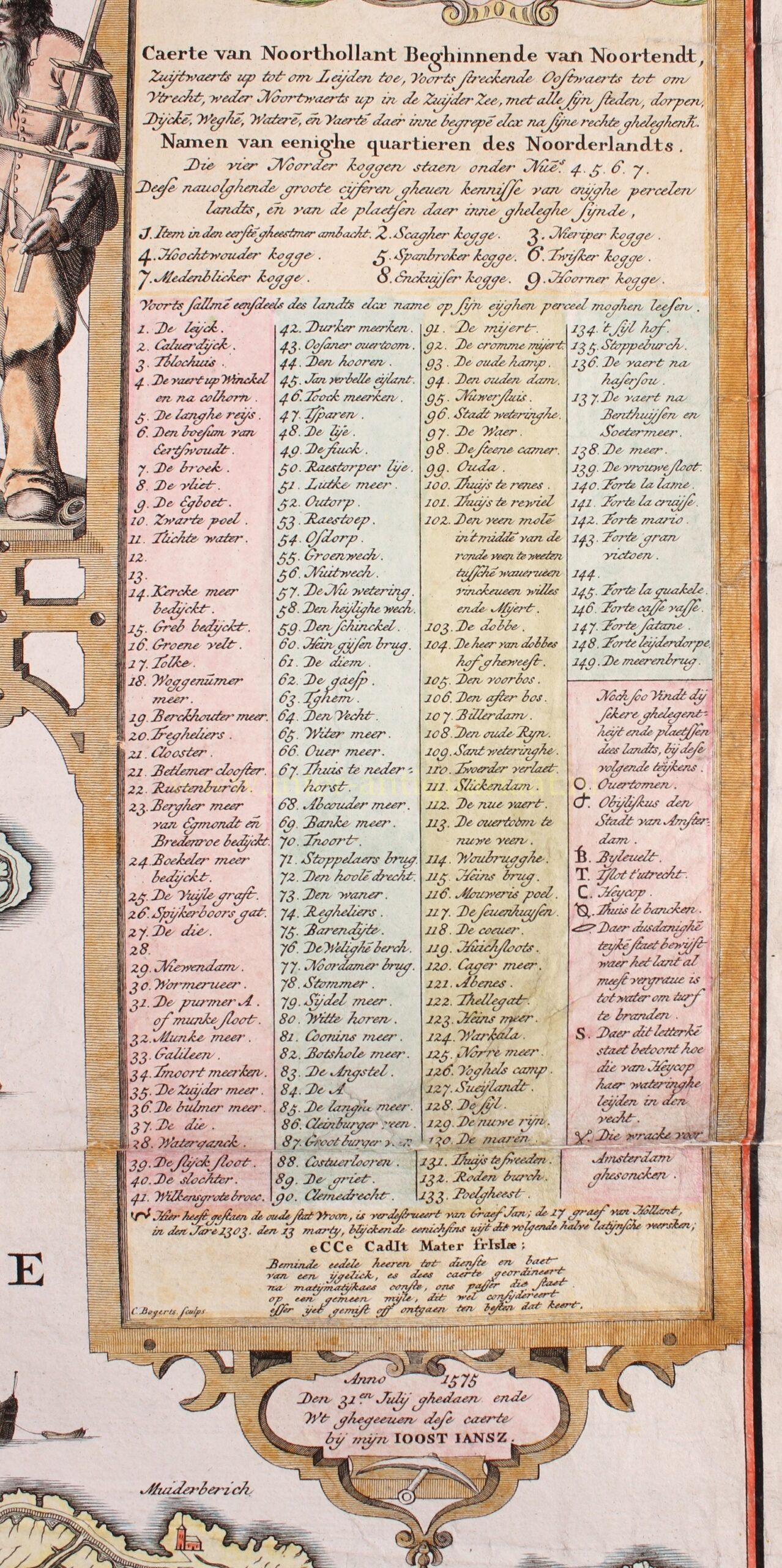
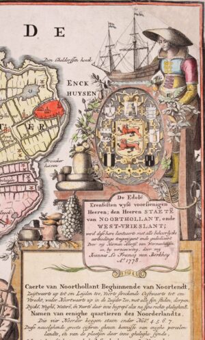
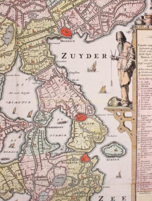
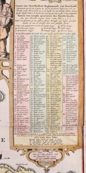
The extended cartouche on the right consists of several parts. At the top a woman in North Holland clothing, she presents a shield on which the coat of arms of West Friesland is in the middle, surrounded by the coats of arms of the seven North Holland cities. Next to the woman is a fluyt that was used as a cargo ship by the merchants in the towns on the Zuiderzee. Next to the coats of arms there is bacon and various cheeses made in the region, as well as tubers, potatoes, carrots and other local agricultural products. Below that, again referring to the activities of the North Hollanders, a sailor with a Jacob’s staff, compass and sinker for depth sounding in his hands. At his feet lies a roll of maps and an astrolabe, a measuring instrument for navigation at sea.
Joost Jansz. Beeldsnijder or ‘Bilhamer’ (1541-1590) was a cartographer from Amsterdam active in many areas. He has worked as a sculptor, land surveyor, fortification engineer, clockmaker and map maker.
Literature:
- Donkersloot-De Vrij, “Topografische Kaarten van Nederland vóór 1750”, nr. 677 III
- Blonk en Blonk – van der Wijst, “Hollandia Comitatus”, pp. 35-36.
- Ron Guleij, “Het grote kaartenboek. Vijf eeuwen cartografie”, pp. 188-191
Price: Euro 7.950,- (incl. frame)