

Scotland antique map – Schenk/Visscher, c. 1690-1720
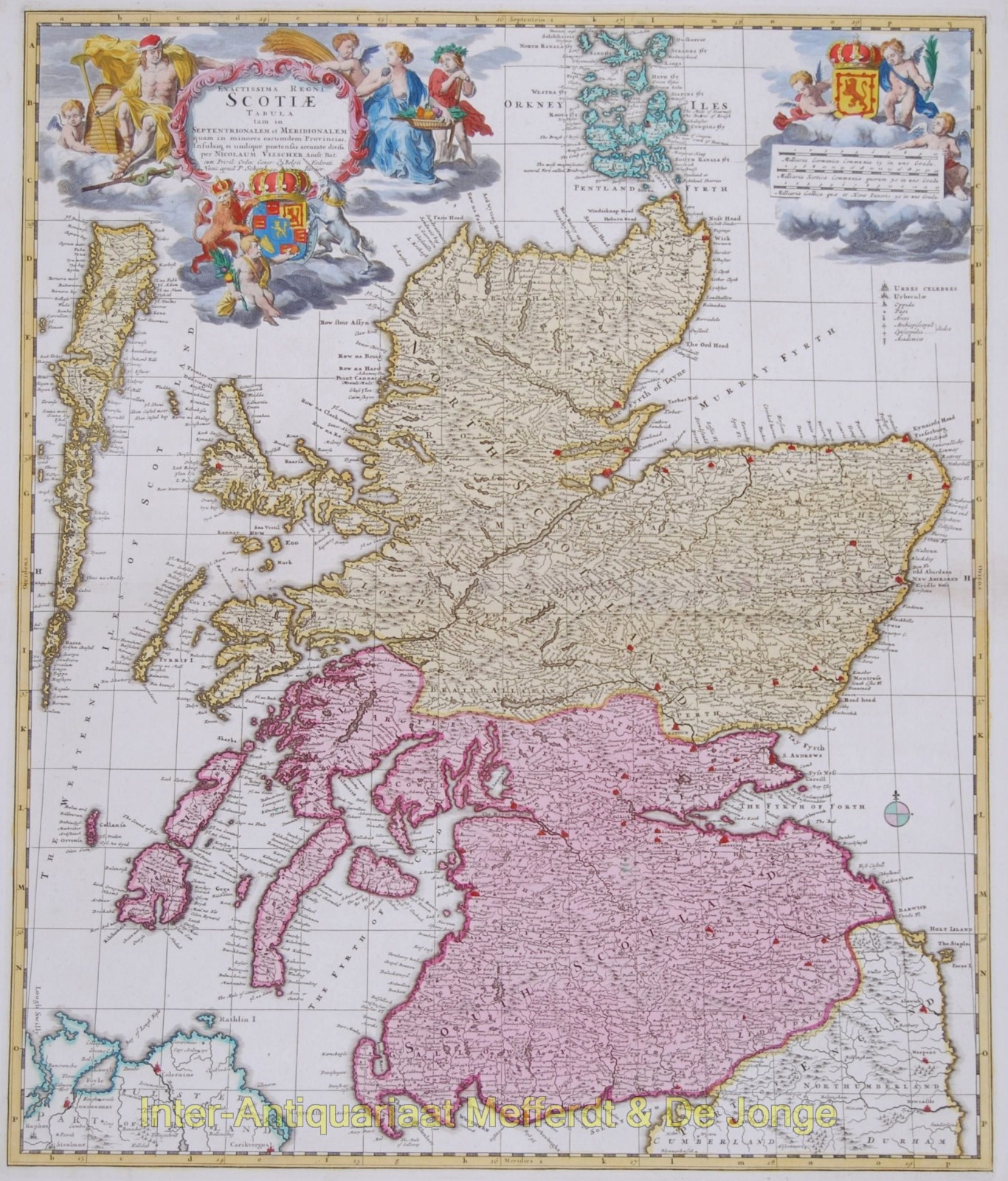
Scotland antique map – “Exactissima Regini Scotiae Tabula”
A large and attractive map of Scotland, divided into north and south. With an ornate title cartouche with the Royal arms of Great Britain and Scotland, and allegorical figures. Very nice detail, including many towns, rivers, mountains, lakes, etc.
First published by Nicolaes Visscher, this example was re-issued by Pieter Schenk around 1690-1720. Original hand colouring. Size: 57,2 x 48,0 cm. Verso: blank
price: SOLD