

Schermer polder – Joan Blaeu, 1658-1672


RECLAIMED LAKE SCHERMER
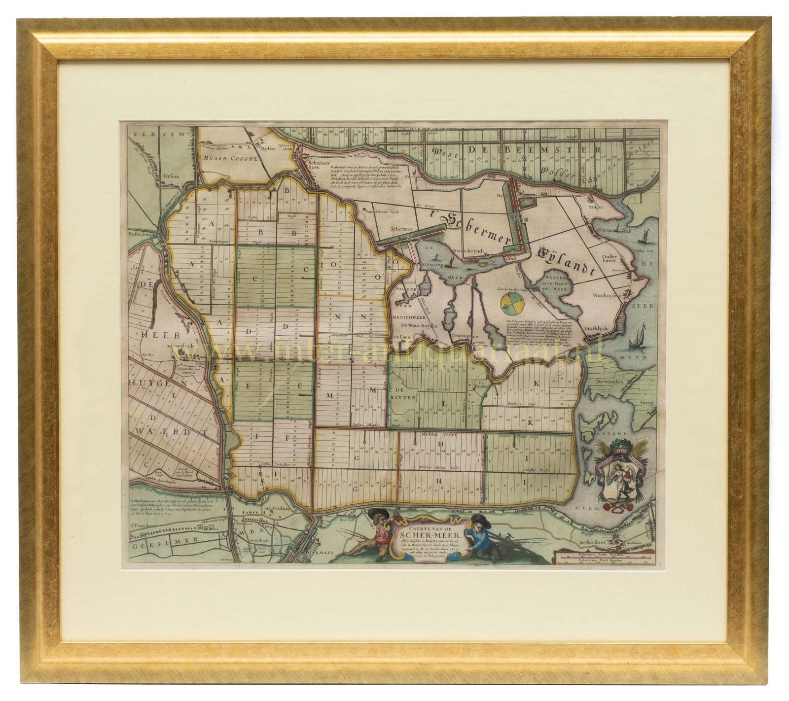
“Caerte van de Scher-Meer“ – Copper engraving published by Joan Blaeu between 1658-1672 as part of his Atlas Maior. Verso: Spanish text. With original hand colouring (with later additions?). Size: approx. 46.5 x 56.5 cm.
In the 17th century, many lakes in what is now the province of North Holland were drained. These were private enterprises, often with a dual purpose. On one hand, the large lakes posed a threat to the surrounding cities, while on the other, the reclamation created fertile agricultural land due to the clay soil, which could then be leased. After the resounding success of the Beemster polder, plans were also made to drain other lakes. Eventually, in 1633, a plan was devised to reclaim lake Schermer, and by 1635, this endeavor was completed.
This map depicts the parceled-out Schermer, with the Beemster and part of the old land, the Schermer Island, visible in the upper right. The Huygendijk (on the left) separates the Waart (Heerhugowaard) from lake Schermer.
The title cartouche at the bottom of the map is flanked by two boys holding fishing rods. In the lower right, a coat of arms featuring the patron saint of the Schermer can be seen. The map contains descriptive texts about Schermer Island, Beemster, and Heerhugowaard. One such note states that the Beemster reclamation was completed on July 30, 1612, and that this date is commemorated annually with a fair.
Price: SOLD