
Guyana and Suriname – Jacques-Nicolas Bellin, 1757
€250
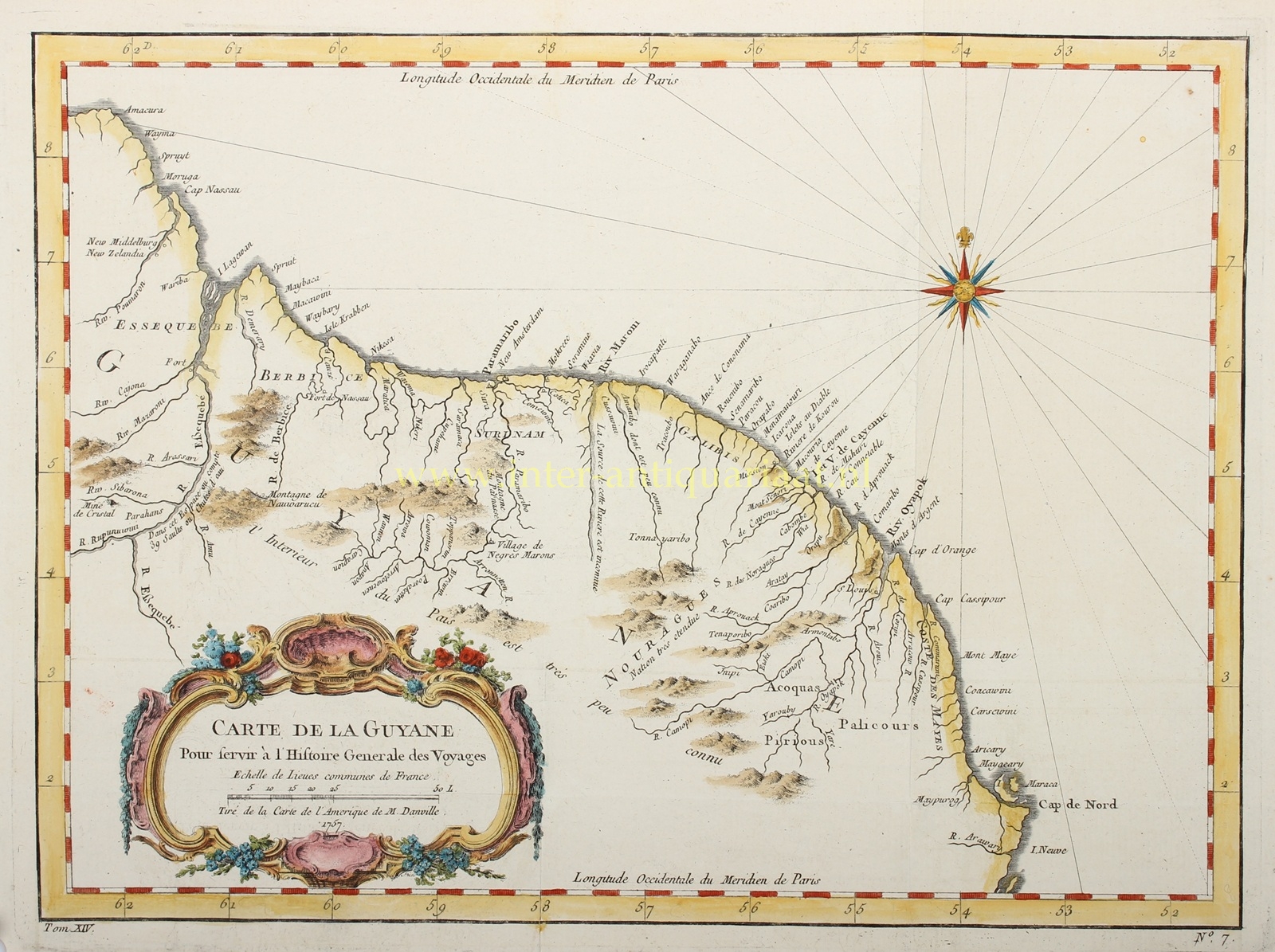
“Carte de la Guyane. Pour servir à l’Histoire Générale des Voyages”, copper engraving made by Jacques-Nicolas Bellin, based on a map by Jean-Baptiste Bourguignon d’Anville, published in Paris in 1757 for volume XIV of Antoine-François Prévost’s Histoire générale des voyages. Coloured by a later hand. Size: 25.5 × 38 cm.
The map depicts the northern coast of South America, extending from the mouth of the Essequibo River in the west to Cape North, near the mouth of the Amazon, in the east. The region encompasses present-day Guyana, Suriname and French Guiana, collectively known at the time as the Guianas.
Along the Atlantic coast, the Dutch colonies of Essequibo, Berbice and Suriname are shown, together with the French colony of Cayenne. The map records the numerous rivers flowing from the interior towards the ocean, with settlements and forts marked along their banks. The Dutch settlements of Nieuw Middelburg and Nieuw Zeelandia are indicated on the Pomeroon River, while further east, Fort Nassau is marked on the Berbice River.
Dutch involvement in this region dates back to the early seventeenth century. Essequibo and Berbice developed into Dutch plantation colonies, as did Demerara, which was established later. Suriname came permanently under Dutch control in 1667. The economies of these territories were closely linked to Atlantic trade and plantation agriculture, which relied heavily on the labour of enslaved Africans. Essequibo, Demerara and Berbice were formally ceded to Great Britain in 1814 and united in 1831 to form British Guiana, now the independent nation of Guyana.
Remarkably, the map devotes considerable attention to the rivers and the interior, even though large parts of this territory remained virtually unknown to European geographers. This is reflected in the revealing annotation “L’Interieur du Pays est très peu connu” [The interior of the country is very little known]. Several Indigenous peoples are also identified, including the Acoquas, Palicours and Pirious. Particularly noteworthy is the inscription “Village de Negres Marons”, indicating a settlement of Maroons: people who had escaped slavery and established independent communities in the interior.
Price: Euro 250,-