Showing 49–96 of 161 results
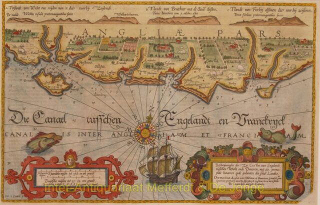
England, coastal chart between Wight and Dover – Waghenaer, 1586
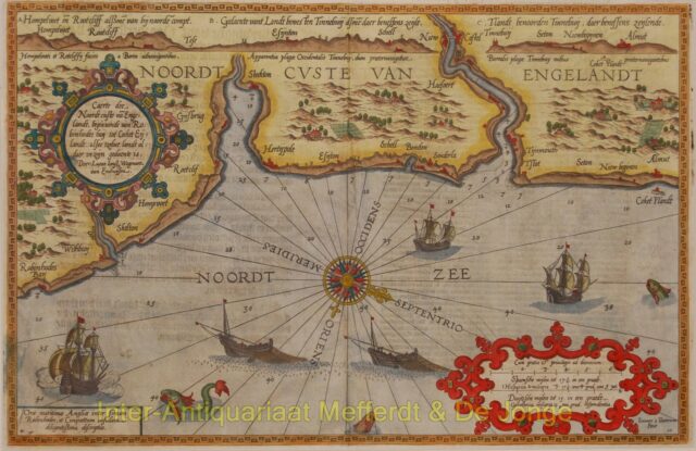
England, from Robin Hood’s Bay to Coquet Island – Waghenaer, 1596
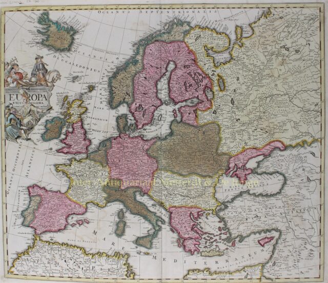
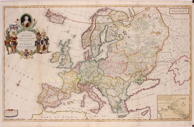
Europa – Pieter Schenk, ca. 1700
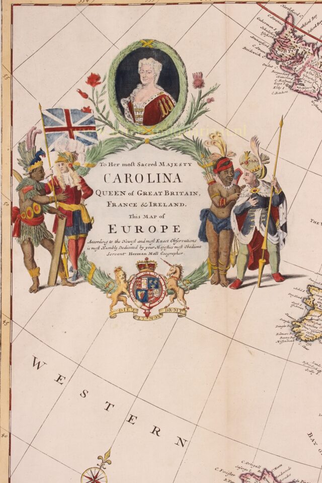
Europe – Herman Moll, 1708
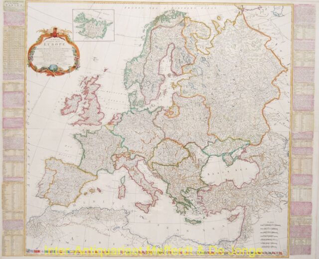
Europe – Thomas Kitchin + Robert Sayer, 1772
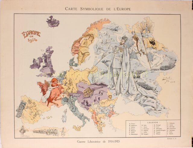
Europe cartoon map – B. Crété, 1914/15
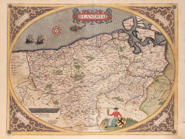
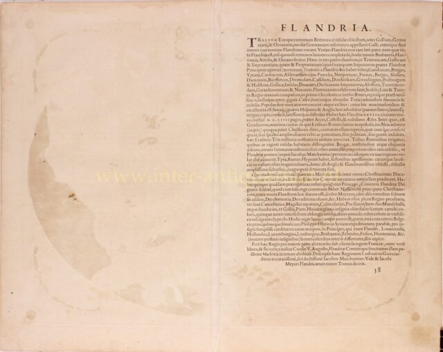
Flanders – Abraham Ortelius, 1579
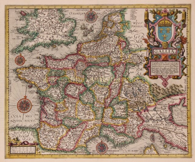
France – Abraham Ortelius, 1606
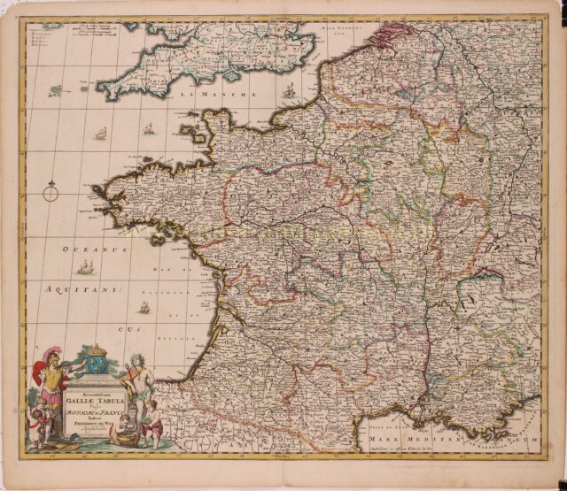
France – Frederick de Wit, c. 1690
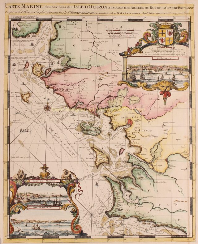
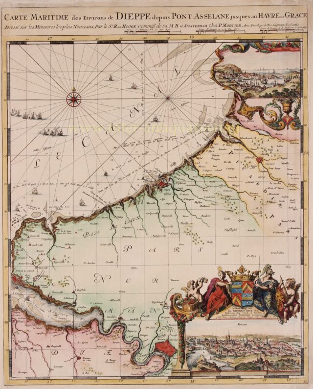
France, Charente-Maritime – Romeijn de Hooghe + Pieter Mortier, 1693
Germany – Johannes Janssonius, 1626
Germany, Low Countries, Poland, Baltics – Melchior Tavernier, 1645
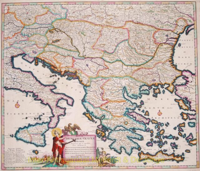
Greece, Balkans – Danckerts, 1684
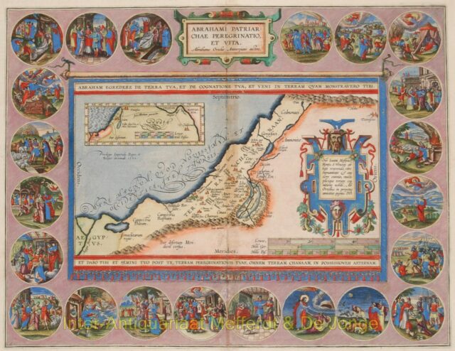
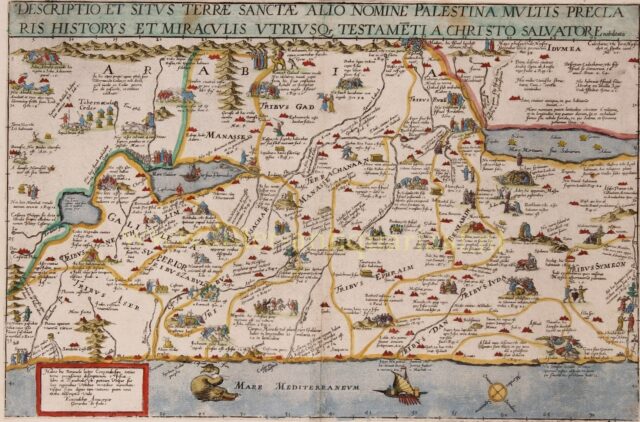
Holy Land – Abraham Ortelius, 1595
Holy Land – Gerard and Cornelis de Jode, 1593
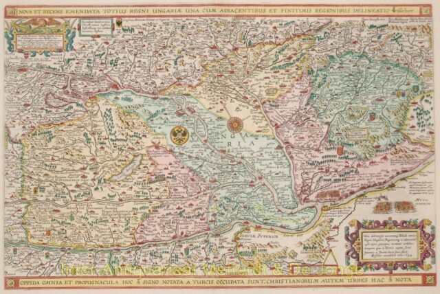
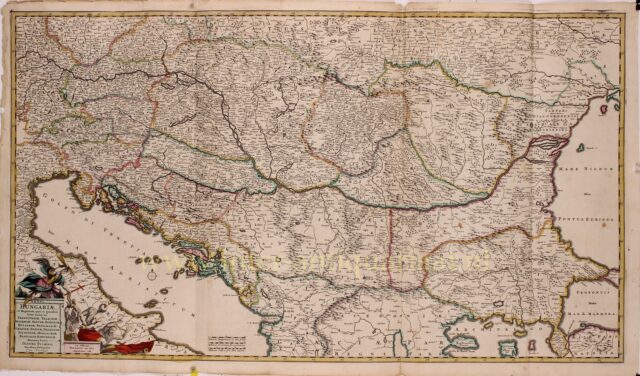
Hungary – Johannes van Doeticum + Claes Jansz. Visscher, 1634
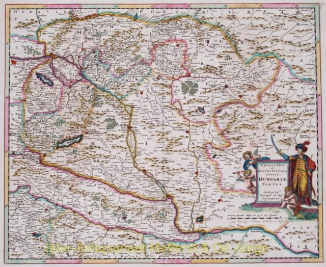
Hungary – Justus Danckerts, 1684
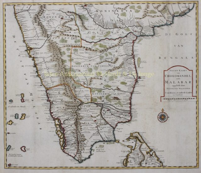
India – François Valentyn, 1724-1726
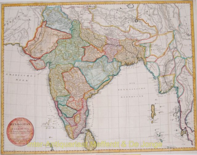
India antique map – Mannert, 1804
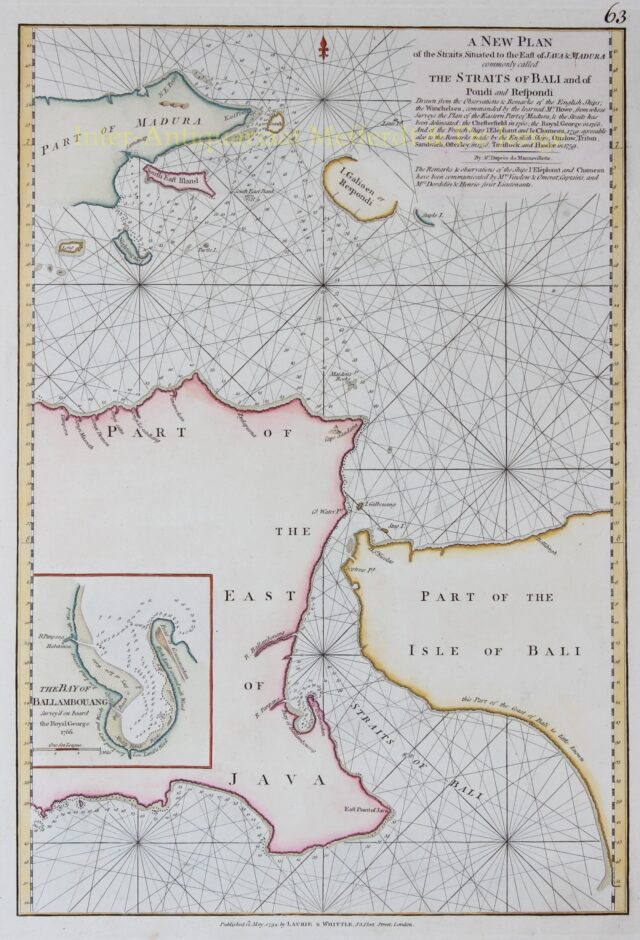
Indonesia, Strait of Bali – Laurie and Whittle, 1794
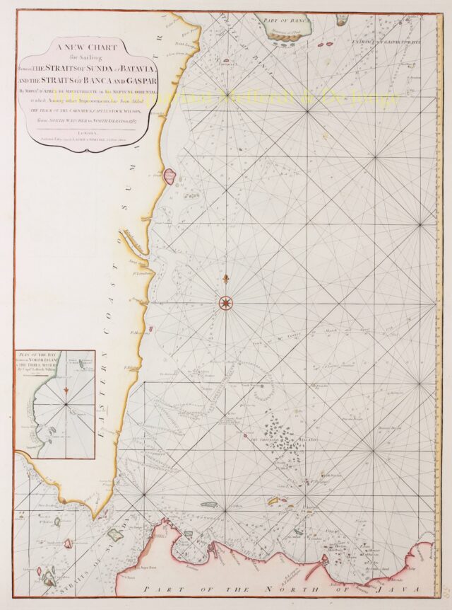
Indonesia, Strait of Sunda or Batavia – Laurie and Whittle, 1794
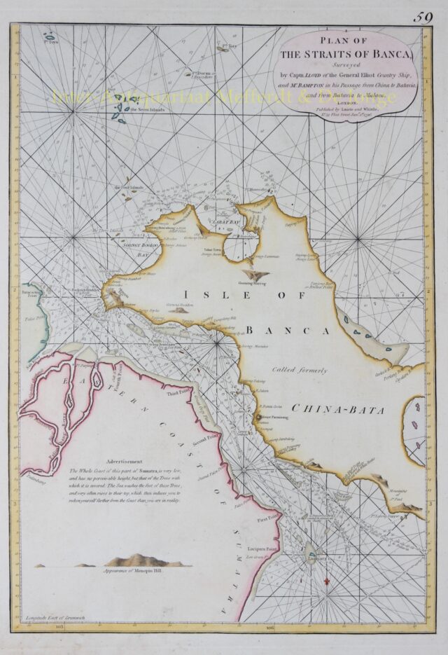
Indonesia, Straits of Banca – Laurie and Whittle, 1796
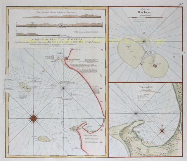
Indonesia, West Coast of Sumatra – Laurie and Whittle, 1794
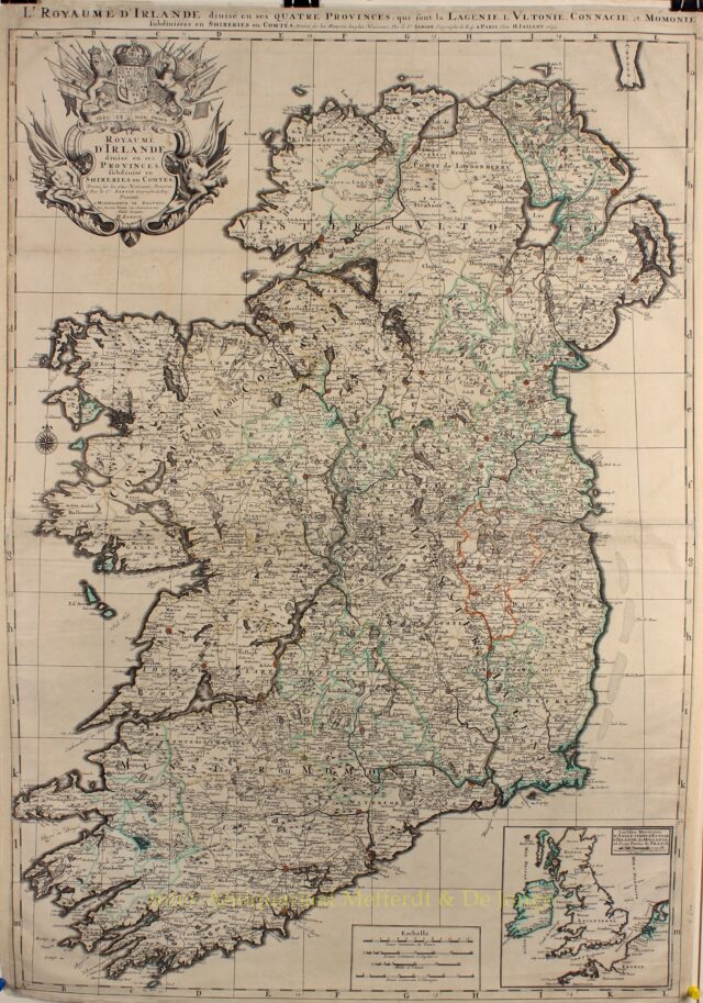
Ireland – Alexis-Hubert Jaillot, 1693
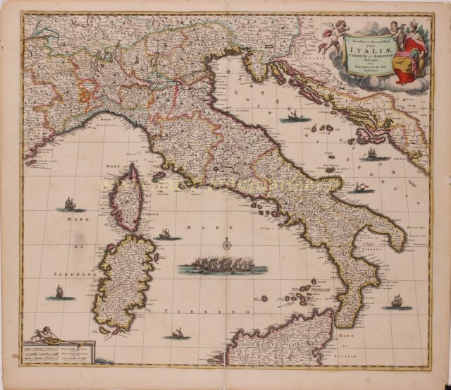
Italy – Frederick de Wit, 1680
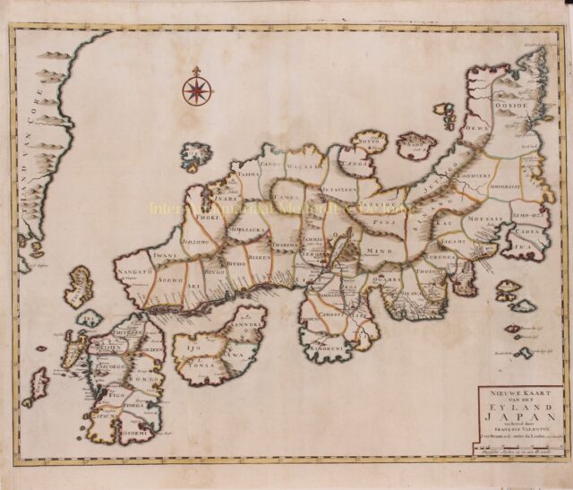
Japan – François Valentijn, 1724-1726
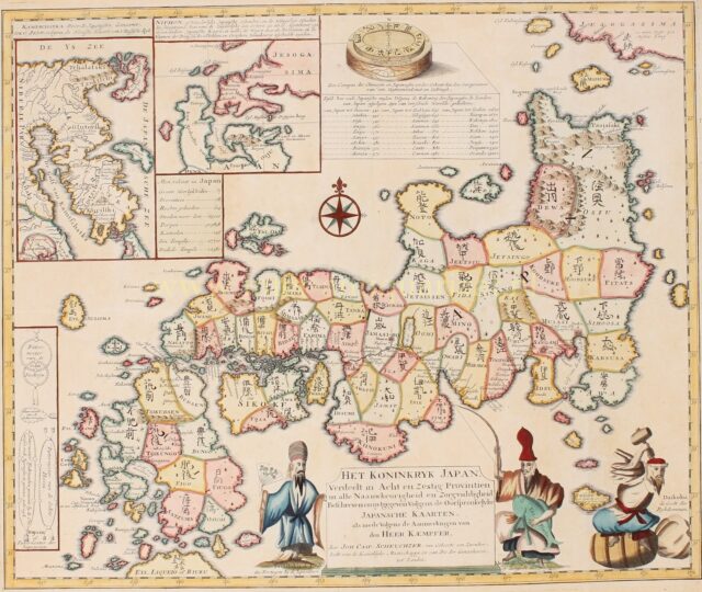
Japan – Johann Caspar Scheuchzer after Engelbert Kaempfer, 1729/1733
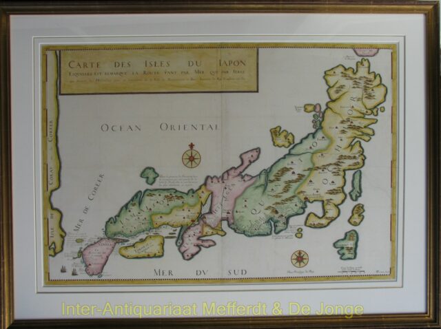
Japan map – Durant after Tavernier
Kingdom of Hungary, Balkans – Frederick de Wit, 1688
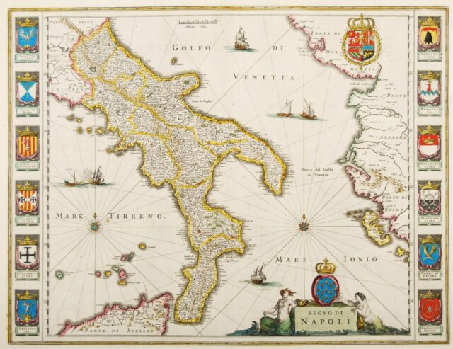
Kingdom of Napels – Blaeu, c. 1640
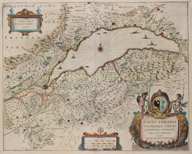
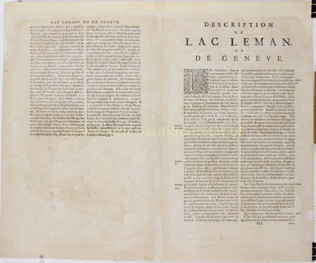
Lake Geneva/Lac Leman – Willem Blaeu, c. 1640
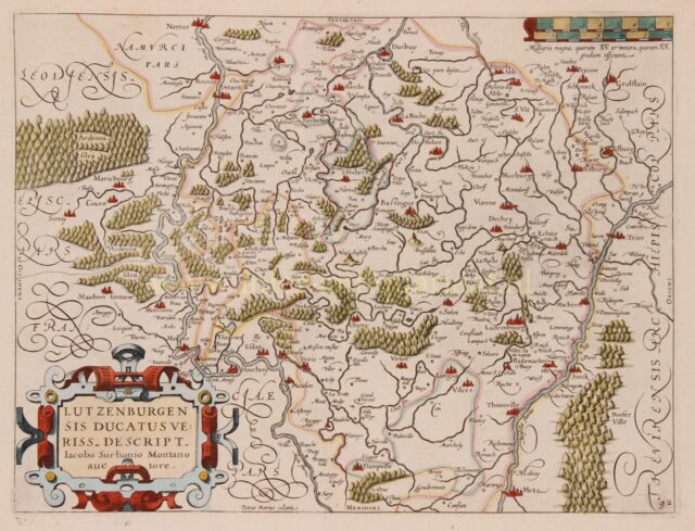
Luxembourg – Petrus Kaerius / Ludovico Guicciardini, 1609
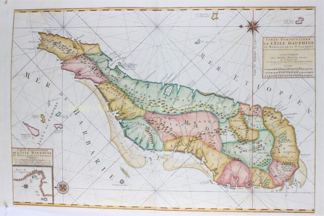
Madagascar – Pieter Mortier, c. 1700
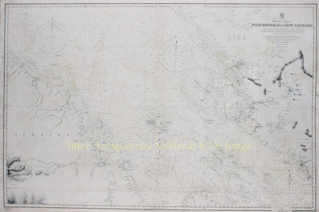
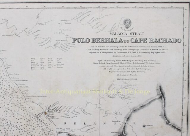
Malacca Strait, Kuala Lumpur – 1895
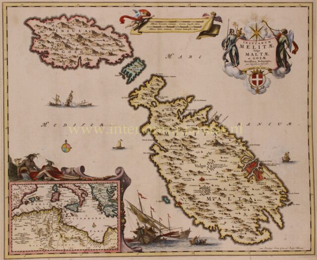
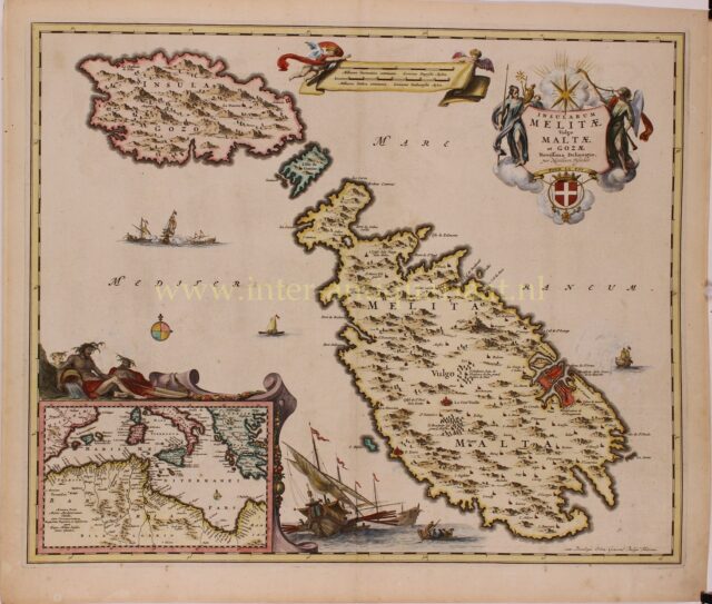
Malta and Gozo – Nicolaes Visscher, c. 1680
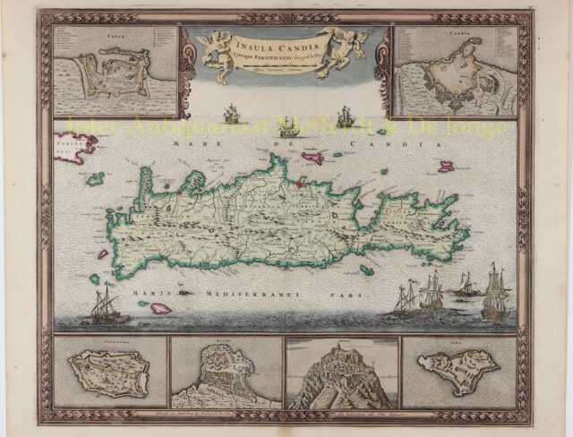
Map of Crete – Frederick de Wit, c. 1680
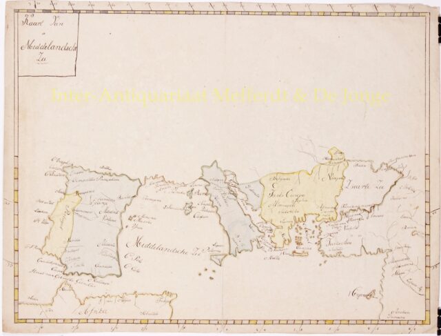
Mediterranean – 19th century
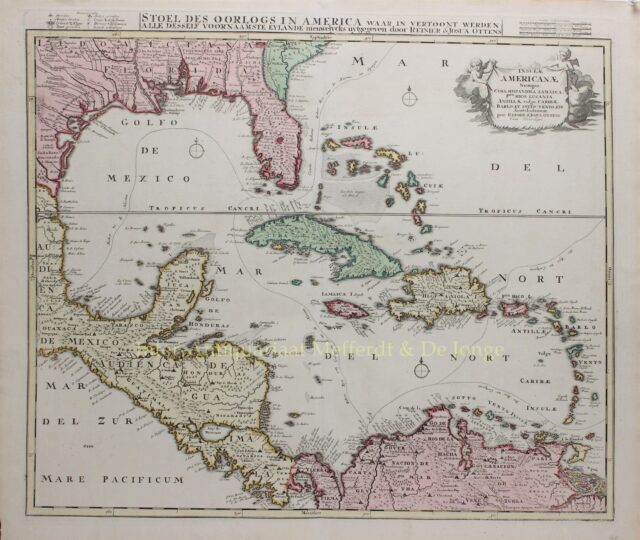
Mexican Gulf, Caribbean – Ottens, ca. 1720
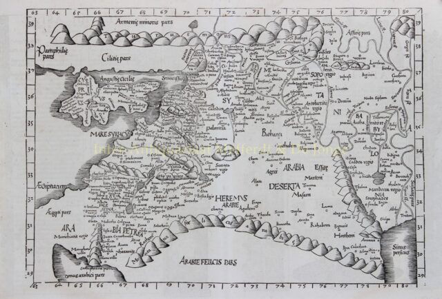
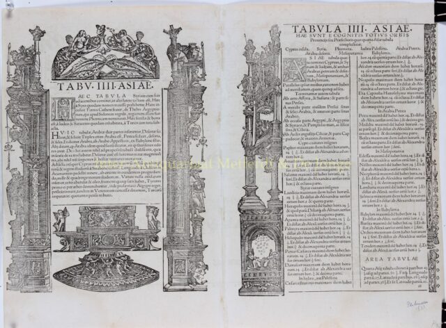
Middle East – Laurent Fries/Johannes Grüninger after Claudius Ptolomeus, 1535
Namur County – Abraham Ortelius, 1576-1612
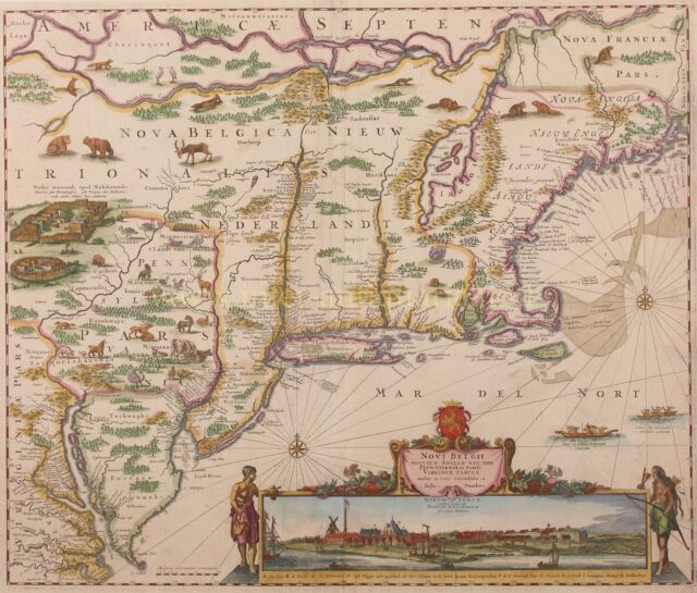
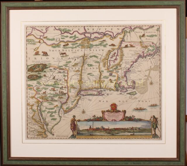
New Netherland, New Amsterdam (New York) – Justus Danckerts, 1690
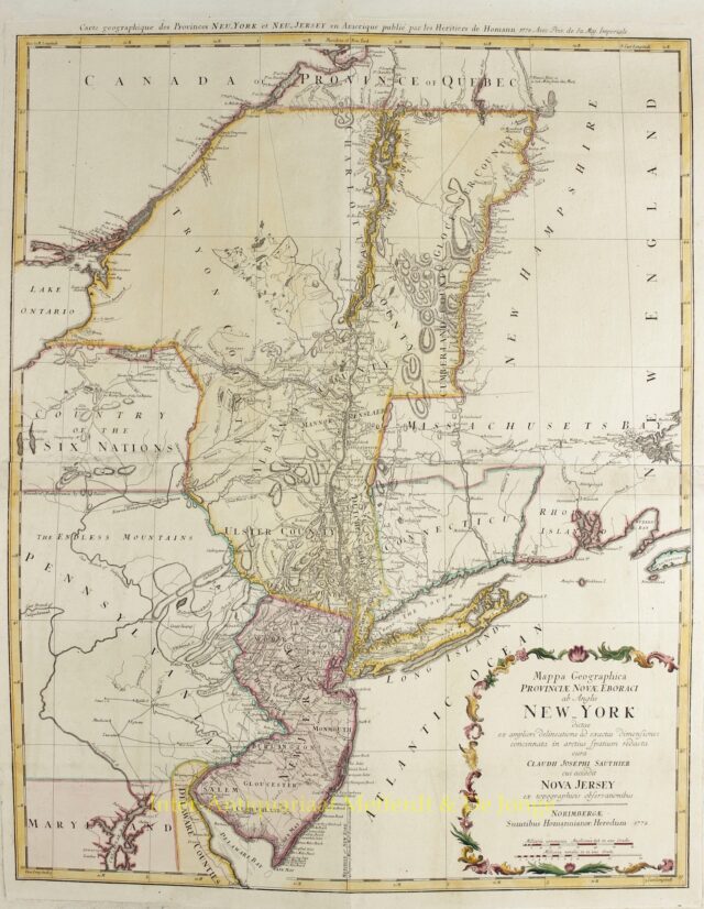
New York and New Jersey – Homann Heirs, 1778
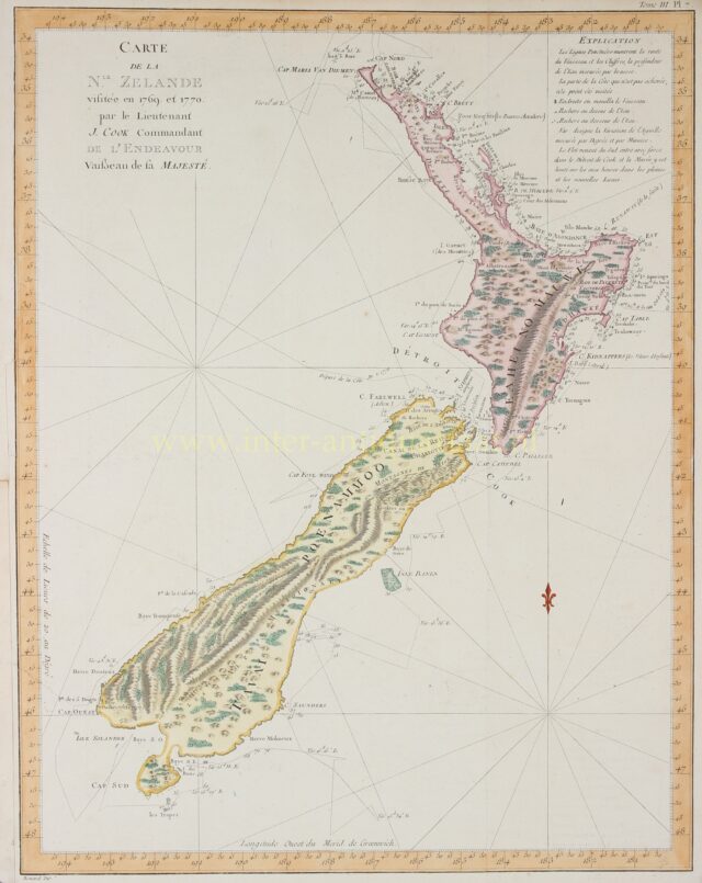
New Zealand – James Cook, 1774
Normandy and Picardy – Romeijn de Hooghe, Pieter Mortier, 1693
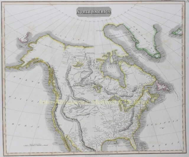
North America – John Thomson, 1814
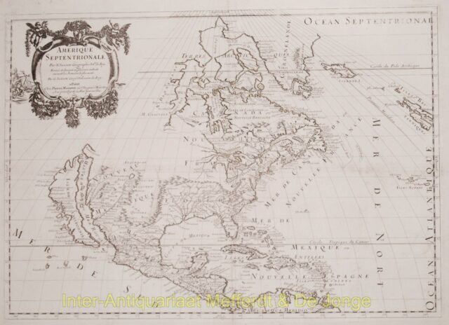
North America antique map – Sanson
North America, Virginia, East coast antique map – Blaeu
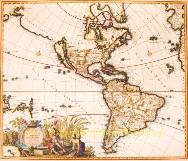
North and South America – Carolus Allard, c. 1697
Username or email address *
Password *
Remember me Log in
Lost your password?